Desktop LiDAR classification software for production point clouds.
Vecten Desktop classifies airborne and UAV LAS, LAZ, and COPC blocks locally, then publishes classified point cloud outputs that production teams can review before handoff.
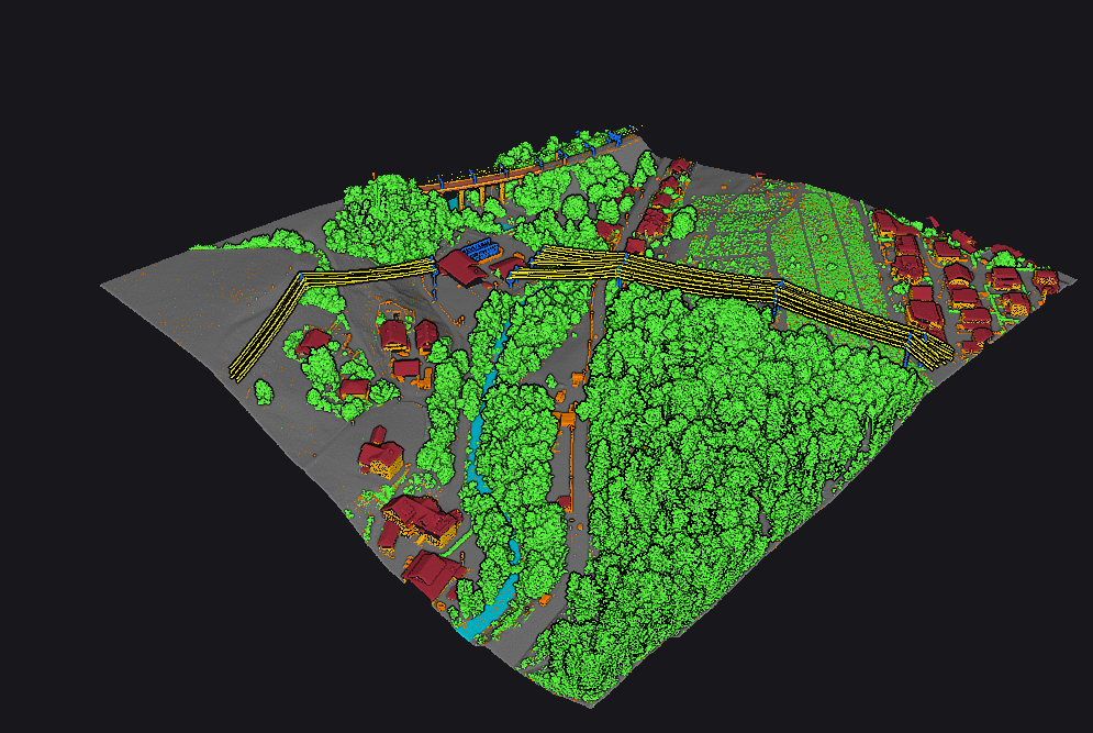
From point cloud blocks to classified outputs.
Projects and blocks
Organize LiDAR work into local projects and blocks so each run stays tied to its source data and output state.
Local classification
Run classification with VClassify, VGround, or VUtilities depending on the classes the production job requires.
Reviewable outputs
Publish classified point cloud outputs with review context so teams can check the result before delivery or downstream use.
Three classification modules inside one desktop workflow.
VClassify
Core point cloud classification for mapping and infrastructure blocks, including ground, vegetation, buildings, bridge decks, and noise where required.
VGround
Ground-focused LiDAR classification for teams preparing terrain review and downstream surface work.
VUtilities
Corridor classification for utility work, including wire conductors, poles, and transmission towers.
Continue by workflow, industry, or product detail.
Evaluate Vecten Desktop for LiDAR classification.
Share the LiDAR work type, required classes, and local-processing constraints. We will confirm whether Vecten Desktop fits the evaluation.