Local desktop LiDAR classification software.
Vecten Desktop organizes LiDAR work into local projects and blocks, runs classification locally, and publishes classified point cloud outputs with review layers and attributes so production teams can check quality faster.
Three AI modules, the classes your job needs.
Vecten Desktop classifies LiDAR locally with proprietary AI models built for production point cloud work. It offers three modules: VGround for ground and terrain extraction, VClassify for semantic class separation, and VUtilities for utility-corridor assets. Each run produces classified point clouds with review layers, shapefiles, and attributes so production teams can check quality faster and reduce manual cleanup.
VGround
Ground, terrain base, and structural deck classes.
- Ground
- Bridge decks
- Noise
VClassify
Everything in VGround, plus the core semantic classes.
- Ground
- Vegetation
- Buildings
- Bridge decks
- Noise
VUtilities
Everything in VClassify, plus utility corridor assets.
- Ground
- Vegetation
- Buildings
- Wires
- Poles & towers
- Bridge decks
- Noise
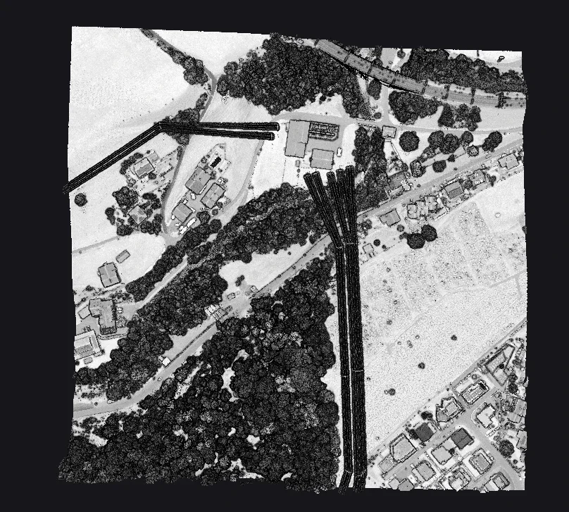
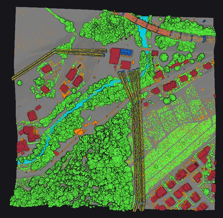
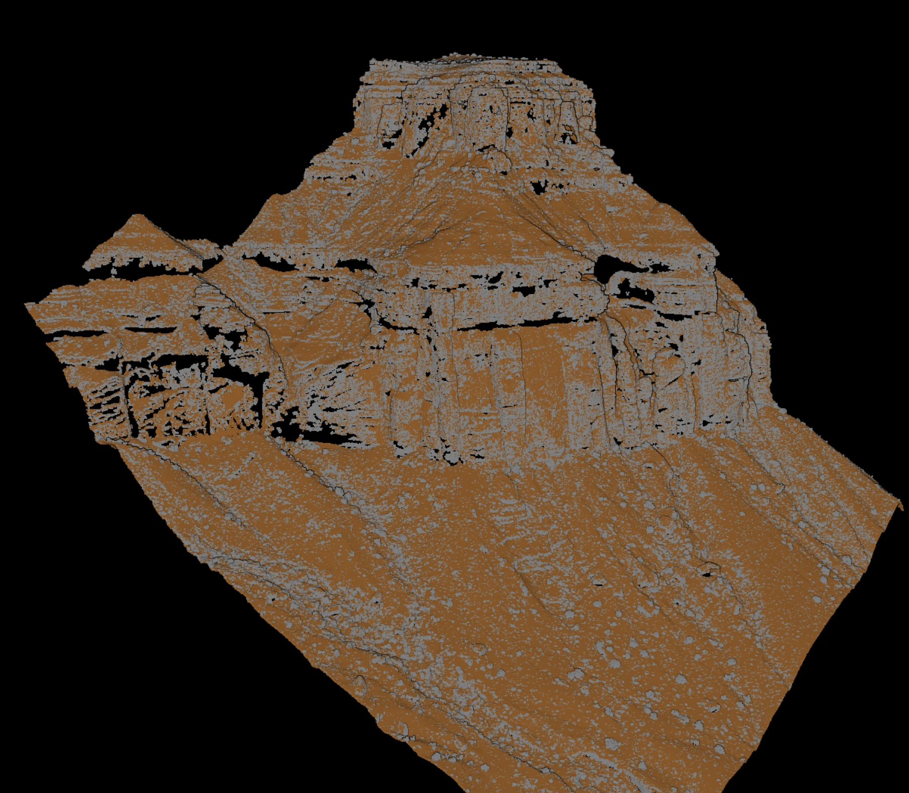
Real classified outputs by module.
Use these examples to judge which module fits the job: terrain extraction with VGround, semantic class separation with VClassify, and corridor asset classification with VUtilities.
Runs on hardware production teams already own.
- Workstation
- Modern desktop workstation with a dedicated GPU.
- Inputs
- LAS, LAZ, and COPC point cloud blocks from airborne and UAV surveys.
- Distribution
- Early-access build from the Vecten team
Detailed requirements are shared during the guided evaluation.
Evaluate Vecten Desktop on your production context.
Bring representative block details, required classes, current toolchain, and review requirements. We will walk through local classification fit.