GeoAI Quebec
GeoAI Quebec and AI Mapping Services
GeoAI, AI mapping, LiDAR classification, imagery intelligence, and geomatics AI services for organizations in Quebec.
We transform point clouds, imagery, and orthophotos into structured feature intelligence, classified datasets, and temporal change products for operational GIS use.
Request a Quote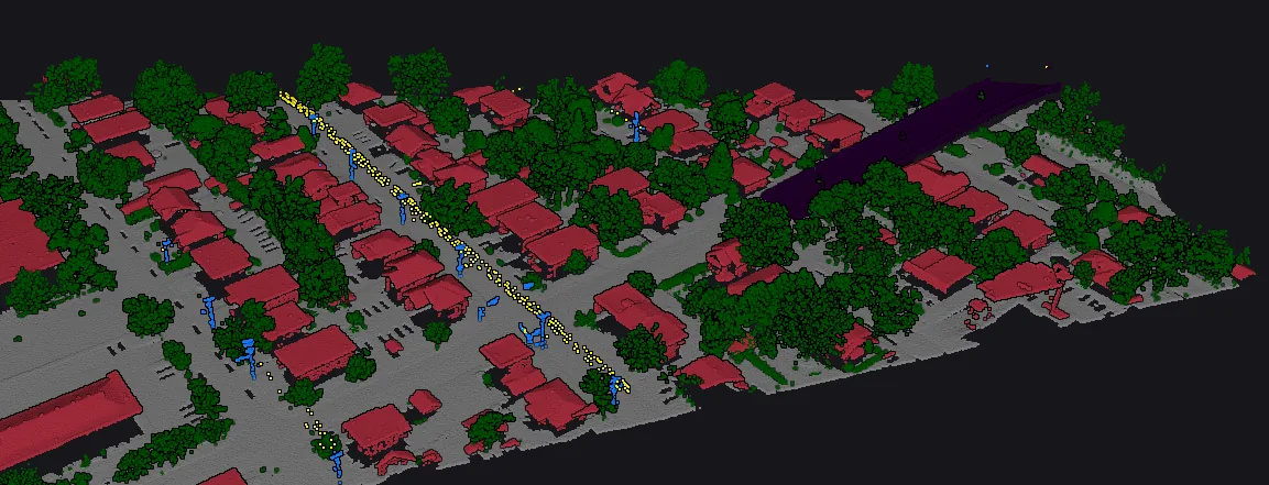
Local GeoAI capabilities
AI mapping from LiDAR, orthophotos, aerial imagery, and geospatial datasets
LiDAR classification for airborne and drone point clouds
Imagery intelligence for buildings, vegetation, pools, surfaces, and visible site features
Geomatics AI workflows that produce clean, reviewable GIS layers
Change detection between capture dates for mapped features and operational monitoring
GIS-ready deliverables
Classified LiDAR point clouds
Building footprint polygons
Vegetation and individual tree layers
Property feature detection layers
Change polygons with added, removed, and modified flags
QC indicators and review layers for production teams
Who we serve
Municipal and government geomatics teams
Utilities and infrastructure corridor teams
Engineering, mapping, and surveying firms
Remote sensing production groups
Property intelligence and insurance teams