What vegetation products can be delivered?
Vegetation intelligence can include canopy extent polygons, individual tree points, tree crown delineation, hedge boundaries, and low-vegetation classes.

Canopy, tree, and vegetation products derived from LiDAR and imagery sources.
Map tree presence, measure canopy extent, and characterize visible vegetation structure across your area of interest.
Explore Vegetation Products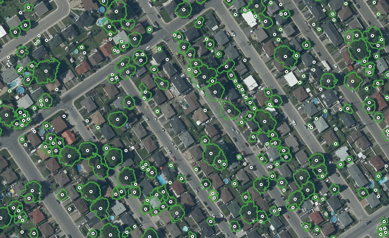
Vegetation products prepared for canopy analysis, field planning, and change review.
Vegetation intelligence can include canopy extent polygons, individual tree points, tree crown delineation, hedge boundaries, and low-vegetation classes.
Products can be derived from LiDAR, imagery, or combined sources depending on the project area, required detail, and available captures.
Yes. Multi-temporal workflows can identify canopy gain or loss, tree removal, crown modification, and hedge boundary change.
Outputs are structured for canopy analysis, operational planning, review workflows, and GIS integration.
Multi-temporal workflows identify canopy gain or loss, tree removal, crown modification, and hedge boundary change.
Explore Vegetation Products