What LiDAR inputs can be classified?
Airborne and drone LiDAR point clouds can be processed when the data includes sufficient density, coordinate reference information, and project coverage boundaries.

Scalable point cloud classification and feature extraction for airborne and drone LiDAR data.
We convert raw LiDAR point clouds into classified, structured geospatial outputs ready for mapping, spatial analysis, and downstream operational use.
Request a Quote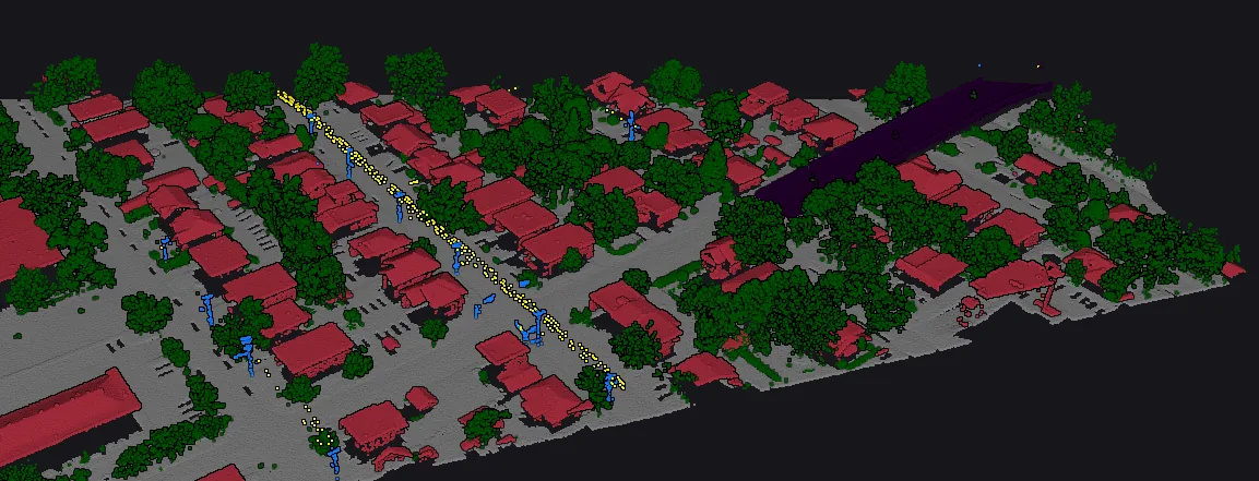
From dense LiDAR captures to organized intelligence layers.
Airborne and drone LiDAR point clouds can be processed when the data includes sufficient density, coordinate reference information, and project coverage boundaries.
Deliverables can follow USGS-standard classes or a utility-specific schema with vegetation, buildings, ground, bridge, wire, and review-focused classes.
Outputs are structured for GIS and production review, including classified point clouds, semantic layers, derivative surfaces, QC flags, and review layers.
Automated classification is paired with QC indicators so production teams can target review time where the data is most likely to need inspection.
Structured outputs for teams that need reliable geospatial production, not one-off demos.