
Solutions
Imagery Intelligence
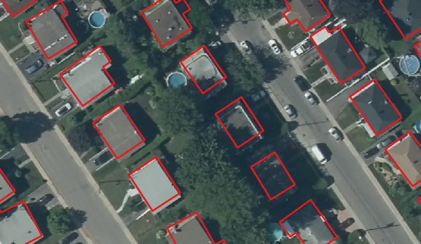
AI-driven geospatial products derived from imagery and aerial imagery.
Structured, GIS-ready products covering buildings, vegetation, land cover, surfaces, and visible site features.
Request a QuoteProduct families derived from imagery
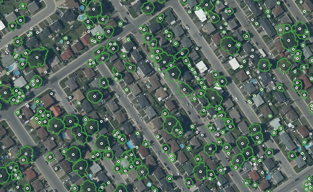
Vegetation Intelligence
Canopy extent, tree crown delineation, hedge mapping, and low-vegetation classification.
Learn more →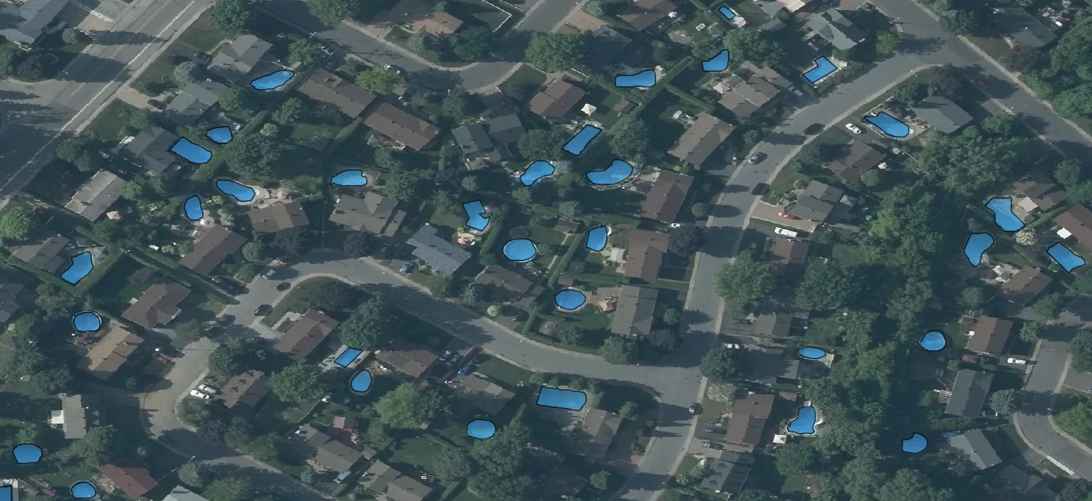
Property Intelligence
Pools, sheds, garages, fences, walls, sports courts, vehicles, and other visible structures.
Learn more →Imagery intelligence FAQ
What imagery inputs are used?
Imagery workflows can use orthorectified imagery, aerial imagery, and project boundaries to produce mapped features at parcel, corridor, municipal, or portfolio scale.
Which product families come from imagery?
Building footprints, vegetation intelligence, property features, land-cover layers, and temporal change products can be delivered as GIS-ready outputs.
Can imagery products support change detection?
Every imagery product can be produced for one capture date or compared across two dates to flag additions, removals, and modifications.
How are outputs delivered?
Outputs are delivered as structured vector or raster layers with review signals so teams can integrate them into existing GIS operations.
Single-date extraction and multi-temporal analysis
Every imagery product supports both single-date feature extraction and date-to-date change analysis between two capture periods.