What is delivered in a building footprint project?
Building footprints are extracted from imagery and delivered as GIS-ready vector polygons for cadastral mapping, planning, and property intelligence workflows.

Automated building outline extraction from imagery and aerial imagery.
For cadastral mapping, property intelligence, urban planning, and geospatial database maintenance.
Request Samples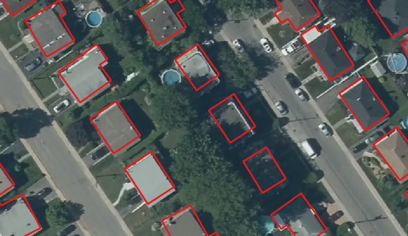
Building layers prepared for GIS teams, review workflows, and downstream property intelligence.
Building footprints are extracted from imagery and delivered as GIS-ready vector polygons for cadastral mapping, planning, and property intelligence workflows.
Large coverage areas can be processed with repeatable extraction, review indicators, and consistent attributes for downstream GIS use.
Yes. Two capture dates can be compared to detect new construction, demolished structures, footprint expansion, and other modifications.
Outputs can be prepared for common GIS environments and spatial databases with schemas agreed before production delivery.
Also available as a multi-temporal workflow to detect new construction, demolitions, building expansion, and footprint modifications.
Request Samples